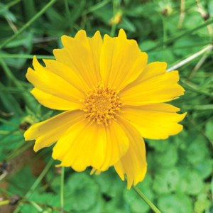


a walk in the woods
housands of tired, nerve-shaken, over-civilized people are beginning to find out that going to the mountains is going home; that wildness is a necessity.” John Muir

Hiking is my favorite outdoor activity. It combines exercise with natural beauty. Solo hiking gives me the chance to think and reflect, away from distractions, in a calming environment I see as a cathedral. Hiking with others allows me to share the sense of wonder at once-in-a-lifetime sights and scenes. According to WebMD, hiking can lower your risk of heart disease, your blood pressure and blood sugar levels. It can boost bone density, strengthen your core, glutes, quads, hamstrings and the muscles in your hips and lower legs. like most exercise, it also mproves your mood. “Being in nature is ingrained in our DNA, and we sometimes forget that,” says Gregory Miller, president of the American Hiking Society.
I admit, I struggled with this story. Not because I didn’t know what to write but because I didn’t know what to leave out. So this is not even close to a comprehensive guide to hiking and backpacking. There’s no such thing. This is just an overview of a few places where you can get out and discover or rediscover a simple pleasure.
What to bring
You can spend a lot of money and carry a lot of gear. If you’re hiking for the first time, or you haven’t been out in a while, I suggest going as simple as possible for your first couple of trips and see what you’re missing before buying a lot of stuff you could get by without. So, bare bones for sleeping a night or two in the forest is a pack, a tent and a sleeping bag. Like everything else, the balance is between how much you want and how much you want to spend.
This is not the place to advise you what kind of gear to get. Go to a place like REI, Gander Mountain or Cabela’s, and talk with a pro.

Day hikes
- Day pack
- Poncho
- Hat to keep off the rain,
- the sun and the flesh-eating blackflies
- Sunglasses
- Food and water
- Knife
- Insect repellent
Multiple day hikes:
- Everything above plus
- Backpack, tent, sleeping bag (again, talk with an outfitter before making a purchase)
- Sleeping pad, if you don’t like a rocky surface
- Rope or bungee cord
- Compass
- Topographic maps (gives you an idea of how steep the trail is)
- Toilet paper (a roll should last two weeks)
- Soap and shampoo
- Water purification pills
- Extra socks
- More extra socks
- Camp shoes (it feels great to take those boots off)
- About food: I prefer to keep things as basic as possible dried fruit, some power bars, canned fish or chicken. That way I don’t have to weigh myself down with camp stoves and other cooking related items. But if you want a hot meal, there are plenty of food and cooking options you can find out about at the outfitters.
WHERE TO GO
Although this is not nearly a comprehensive list, here are a few pretty good places.
Close to home
Each of these spots is less than half an hour from Mt. Lebanon.
Boyce Mayview Park, Upper St. Clair
Along with the recreation center, ballfields and community garden, Boyce Mayview has a variety of hiking trails that parallel Chartiers Creek and a wetland that was built by PennDOT as mitigation for a construction project.
The trails range across a wide variety of habitats, accessible from several entry points. Park in the community garden next to Boyce Middle School on Boyce Road and follow the trails past the gardens, through meadows and into a forest of mixed hardwoods called for some reason the White Pine Trail and from there down to a large pond and wetlands habitat that PennDOT built.
Drive about a mile past the gardens and park at the Little Falls/Wetlands trails for a more direct route to the wetlands, which are home to several families of nesting geese, a few Great Blue Herons and at least one Bald Eagle. On sunny days, the small islands in the pond are dotted with snapping turtles.
If you enter the park at its other end, off Mayview Road, drive past the recreation center and park near the former Outdoor Classroom. You’ll find more meadow habitat and wooded trails offering great views of Chartiers Creek. www.twpusc.org/rec-leisure/parks-fields
Wingfield Pines
Across Mayview Road from Boyce Mayview is the Wingfield Pines Conservation Area and the Chartiers Greenway, owned by the Allegheny Land Trust. Site of a former strip mine, Wingfield Pines has a passive treatment system for abandoned mine drainage, that was designed by Mt. Lebanon resident Bob Hedin in conjunction with the Pennsylvania Department of Environmental Protection. The system filters more than 40 tons of iron oxide a year out of the mine drainage before it enters the creek, using natural and sustainable technology. The trails wind their way through the ponds, which are accompanied by descriptions of the process. The north end of the trail terminates at Chartiers Park in Bridgeville. www.alleghenylandtrust.org/properties/wingfield/overview
Peters Lake
A relatively short, kid- and dog-friendly walk, Peters Lake is on Center Church Road in Peters. The trail is about ¾ of a mile of hardwood and evergreen forest and open field, and encircles a man-made lake that freezes solid enough for fishing and skating in the winter. You can make it all the way around at a leisurely pace in 40 minutes, or explore the side trails for another hour.
Mingo Creek County Park

Near Finleyville in Washington County, Mingo Creek has something for just about everyone. On opening day of trout season, its namesake creek that winds through the park is lined with anglers. There is an off-leash area for dogs, an observatory, a 2.8-mile paved bike and running trail that runs the length of the park, and hikers share the trails with horseback riders. Most of the trails in Mingo are well maintained but not that well marked, so there is room for wandering. A good place to get lost, but not too lost. www.co.washington.pa.us/index.aspx?NID=164
A little further
Pennsylvania has a stellar system of state parks and state forests, a lot of which are just a few hours away. The Allegheny National Forest is a few hours north, and the Monongahela National Forest a few hours south. State parks in close driving range are Raccoon Creek, Ohiopyle, Cook Forest, Linn Run, Laurel Hill, and many others. Most state parks have cabin and yurt rental available. www.dcnr.state.pa.us/stateparks/index.aspx

The Allegheny National Forest covers 800 square miles in Elk, Forest, McKean and Warren counties. It’s divided into two districts, with ranger stations in Bradford and Marienville. The Beaver Meadows Recreation Area in the Marienville district, and contains about 275 miles of trails. www.fs.usda.gov/allegheny
The Monongahela National Forest in West Virginia is about 1,400 square miles, and occupies some of the highest elevations in the state, ranging from just under 1,000 to 4,863 feet above sea level. The forest is in six districts, each with a ranger station. The forest contains more than 500 miles of trails, ranging in length from under a mile to more than 40. www.fs.usda.gov/mnf
The North Country National Scenic Trail, which stretches from the New York-Vermont border to North Dakota, passes through Allegheny National Forest, and weaves its way through Cooks Forest, Moraine and McConnell’s Mill state parks. northcountrytrail.org

The Laurel Highlands Trail starts in Ohiopyle State Park, and covers 70 miles, ending in Johnstown. Adirondack shelters are roughly six to 10 miles apart throughout the trail. www.dcnr.state.pa.us/stateparks/lhht
The Rachel Carson Trail is 35 miles long, beginning in Harrison Hills County Park, near Tarentum, and ending in North Park. www.rachelcarsontrails.org